


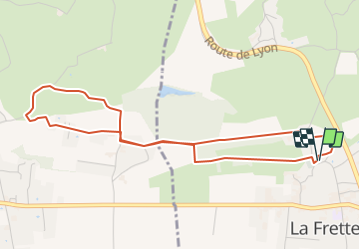
RS-La-Frette-Villardière-et-Plantier

raymondfn
User


1h13
Difficulty : Easy

FREE GPS app for hiking
 SityTrail
IGN / Geographical institutes
SityTrail Plus
The world is yours!
About
Trail Walking of 5 km to be discovered at Auvergne-Rhône-Alpes, Isère, La Frette. This trail is proposed by raymondfn.
Description
Petite balade depuis l'église de la Frette qui fait le tour du château de la Villardière et nous emmène jusqu'au hameau du Plantier (Saint-Hilaire-de-la-Côte), en empruntant le chemin de Compostelle.
Beaux panoramas sur la Bièvre, Chambaran, Chartreuse et Vercors.
Positioning
Comments
